
OSM Geo Mapper
Rust library for querying OpenStreetMap data by coordinates and a terminal application to browse OpenStreeMap data in the terminal. Will parse OSM/PBF/GeoJSON files or fetch OSM data using an address or lat/lon, and display the resulting lines/points/polygons in the terminal.
Allows for moving around the map:
- Arrow keys for directional movement (also supports vi keys h,j,k,l)
- 'z' to zoom in/out
- Hold 'Shift' to move 10x faster
- 'Enter' to load more data at your current location (uses previously chosen radius)
- 'q' or Esc to quit
But Why
I had an idea for a terminal-based zombie survival game set wherever on earth the player chooses.
Turns out, just parsing and enumerating all types of OpenStreetMap data is a significant amount of work and worth it's own library.
This library exposes a thread-safe data structure used for querying OSM data by 2D coordinates roughly mimicking latitude and longitude degrees.
Usage
CLI
./osm-geo-mapper --help

osm-geo-mapper 0.8.0

Will display OpenStreeMap data (PBF/OSM/GeoJSON) lines/points/polygons in the terminal.

USAGE:
    osm-geo-mapper [OPTIONS]

FLAGS:
    -h, --help       Prints help information
    -V, --version    Prints version information

OPTIONS:
-a, --address <address>              The address that will be used when fetching OpenStreetMap data (ignored if OSM/PBF/GeoJSON file is provided)
-g, --geojson-file <geojson-file>    Optionally provide a GeoJSON file directly to be parsed and displayed in the terminal
--latitude <latitude>            The latitude that will be used when fetching OpenStreetMap data (ignored if address or OSM/PBF/GeoJSON file is provided)
--longitude <longitude>          The longitude that will be used when fetching OpenStreetMap data (ignored if address or OSM/PBF/GeoJSON file is provided)
-o, --osm-file <osm-file>            Optionally provide a OSM file directly to be parsed and displayed in the terminal
-p, --pbf-file <pbf-file>            Optionally provide a PBF file directly to be parsed and displayed in the terminal
-r, --radius <radius>                The radius of the area of land to retrieve in 100,000th of a lat/lon degree (roughly a meter at the equator) - defaults to 200 (0.002 degrees or ~200m). Significantly impacts loading times. Ignored if PBF/GeoJSON file is provided

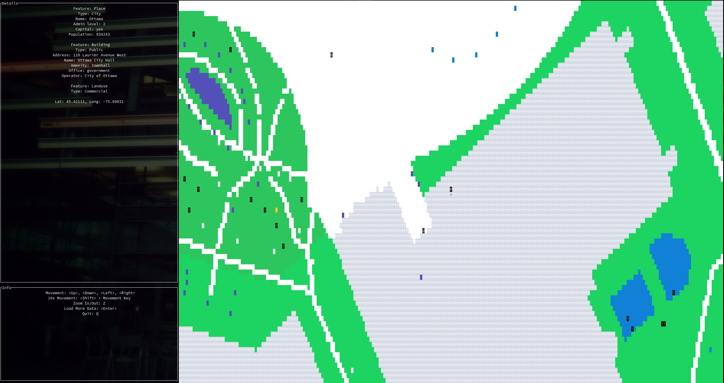
./osm-geo-mapper --address "ottawa canada"
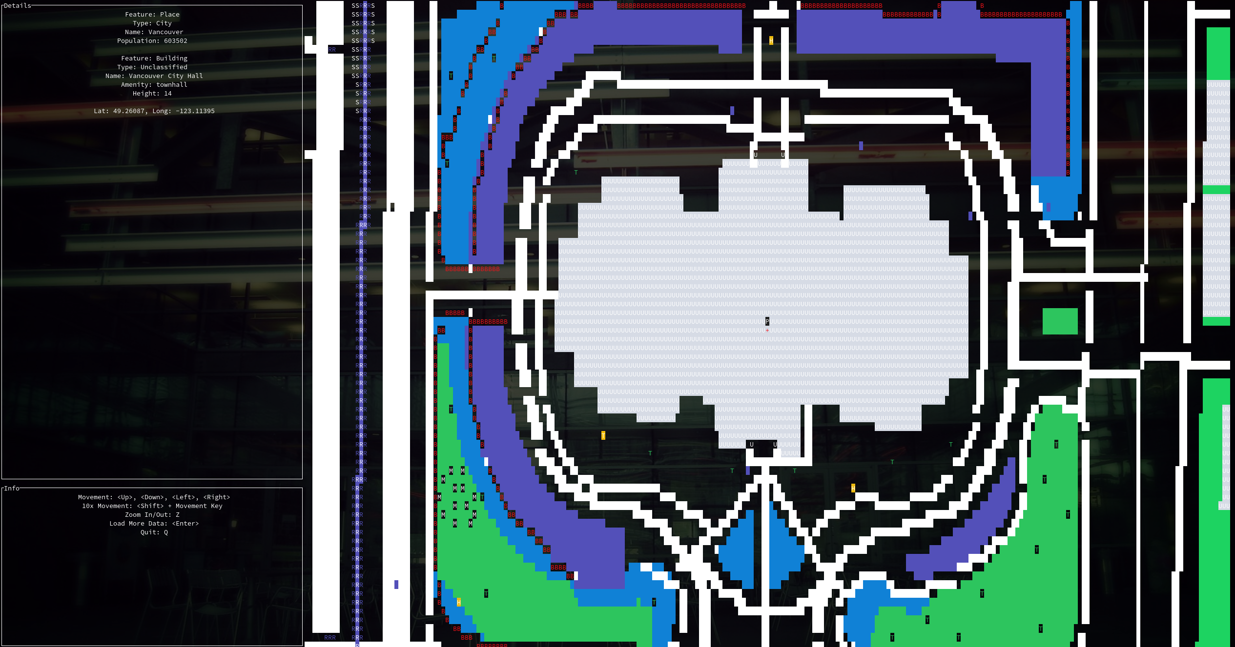
./osm-geo-mapper --address "vancouver canada"
Library
See the tests/ folder for example usage, but it boils down to the following OSMGeoMapper methods:
use osm_geo_mapper::interface::{ OSMGeoMapper, Location };

OSMGeoMapper::from_address(address: String, radius: Option<u32>) -> Result<OSMGeoMapper, Box<dyn std::error::Error>>
OSMGeoMapper::from_address takes an address string and optionally a radius (in 100,000th of a degree, or roughly a meter at the equator) and returns an OSMGeoMapper object.
OSMGeoMapper::from_lat_lon(latitude: f64, longitude: f64, radius: Option<u32>) -> Result<OSMGeoMapper, Box<dyn std::error::Error>>
OSMGeoMapper::from_lat_lon does the same thing as above except it takes a latitude and longitude instead of an address.
OSMGeoMapper::from_geojson_file(geojson_file: String, location: Option<Location>) -> Result<OSMGeoMapper, Box<dyn std::error::Error>>
OSMGeoMapper::from_geojson_file takes a geojson file path directly and also returns a OSMGeoMapper object. The location optional parameter is not useful yet.
The OSMGeoMapper type is defined as follows:
pub struct OSMGeoMapper {
    pub data_structure: Arc<RwLock<HashMap<geo_types::Coordinate<i32>, Vec<Arc<GeoTile>>>>>,
    pub coordinates: geo_types::Coordinate<i32>,
    pub radius: u32
}
data_structure is used to access the various GeoTiles by coordinates. This data structure is thread-safe due to the Arc<RwLock<>> wrapper. Use OSMGeoMapper::atomic_clone(&self) or OSMGeoMapper.data_structure.clone() directly when sending it to another thread. Use OSMGeoMapper::get/get_real() or data_structure.read()/try_read() or data_structure.write()/try_write() to lock the resource for read/write purposes.
coordinates holds x/y coordinates of the address (if OSMGeoMapper::from_address was used) or to the lat/lon initially provided. They are no longer in the original lat/lon format but in the data structure's coordinate system (each step is 100,000th of a degree, or roughly one meter at the equator).
radius is the chosen radius for the original fetching of data (if OSMGeoMapper::from_address or OSMGeoMapper::from_lat_lon was used).
If you wanted to get the GeoTile(s) at the real-world lat/lon of -75.6903082/45.4211063, you would use the following method call - OSMGeoMapper::get_real(45.4211063, -75.6903082). Note that granularity is only to 6 decimal places. The method call above is the same as OSMGeoMapper::get(45421106, -75690308)
You can also get GeoTile(s) directly from the OSMGeoMapper.data_structure field (once read-locked) like this: data_structure.get(geo_types::Coordinate { x: -7569031, y: 4542111 })
You can convert to/from real and OSMGeoMapper coordinates using the following helper functions: osm_geo_mapper::operations::to_tile_scale(f64) -> i32 and osm_geo_mapper::operations::from_tile_scale(i32) -> f64.
A GeoTile can be many many things - see features.rs.
You can also load more data into your OSMGeoMapper.data_structure using one of the following three helper methods:
OSMGeoMapper::load_more_from_lat_lon(&mut self, latitude: f64, longitude: f64, radius: Option<u32>) -> Result<(), Box<dyn std::error::Error>>

OSMGeoMapper::load_more_from_address(&mut self, address: String, radius: Option<u32>) -> Result<(), Box<dyn std::error::Error>>

OSMGeoMapper::load_more_from_geojson_file(&mut self, geojson_file: String) -> Result<(), Box<dyn std::error::Error>>
See the test_multiple_threads() test function in tests/lib_tests.rs to see an example of loading data in multiple threads simultaneously.
TODO
- Implement logic to choose a lat/lon in the middle of a geojson file if none is provided via command line
- Implement (binary?) serialization of map data to be loaded/cached
- Continue tweaking the themes
- Need logic to handle rate-limited Overpass API calls (need to parse XML response)
ISSUES
Shift + Movement doesn't work in certain terminal emulators (confirmed in urxvt).